

Our Peak District hill walking challenge: climbing the 95 ‘Ethels’
You’ve heard of the Munros in Scotland and the Lake District Wainwrights. Now there’s a new hill walking challenge for the summits of the Peak District – the ‘Ethels’!
The Ethels are all the Peak District hilltops over 400m above sea level. And some significant lower prominent hills that stand out in their own right. There are 95 in total – enough to keep the keenest hill walkers busy for many months to come.
We’ve mapped and listed them on a new smartphone app that we’ve released to coincide with our 97th birthday in May 2021.
And we’ve named them the Ethels. That’s in tribute to our charity’s founder, the pioneering environmentalist Ethel Haythornthwaite.
Who was Ethel Haythornthwaite?
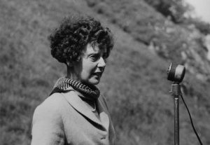
Ethel created the charity in 1924. She found refuge in the beautiful countryside near her Sheffield home, after her husband Captain Henry Gallimore was killed in the First World War. She was just 22-years-old at the time.
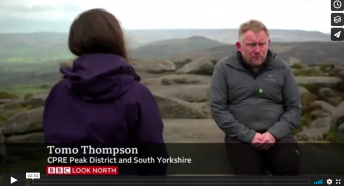
“Ethel was lost in grief,” said CPRE PDSY chief executive Tomo Thompson.
“Her parents suggested that she took restorative walks in the countryside around the city. It’s an area we now know as the Peak District.
“Those walks and landscapes had a profound effect and literally changed her life. She went on to create the countryside charity that we now know as CPRE Peak District and South Yorkshire
“She helped protect wild areas like Longshaw and Blackamoor from development by organising their purchase for public access. She was also a key figure in creating the Peak District as Britain’s first national park seventy years ago.
“Today so many more people are finding refuge from Covid lockdown in the countryside on their doorsteps. So we thought it apt to create this new hill walking challenge in Ethel’s memory.
“On our 97th birthday we wanted to give something back to the communities that have supported us. We also want to inspire others to come to this remarkable part of England.”
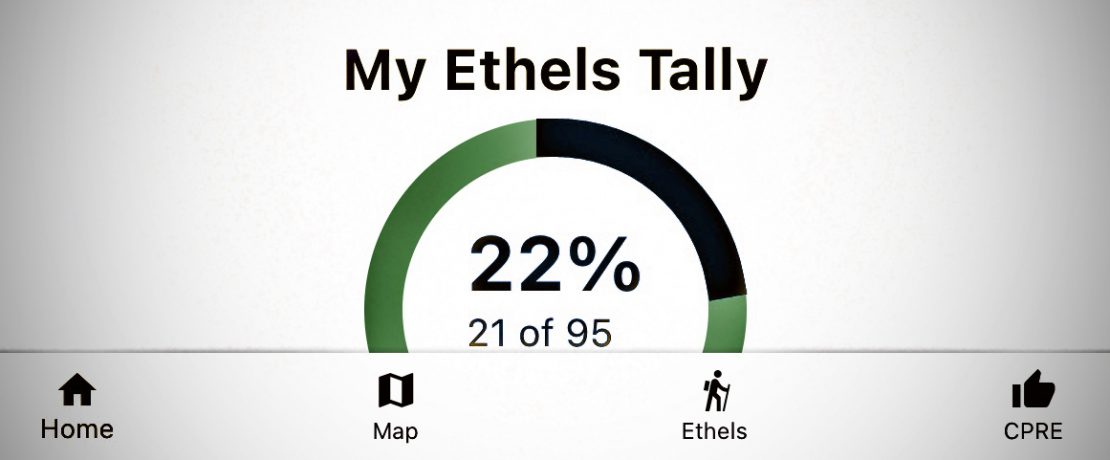
How does the smartphone app work?
The smartphone app maps all 95 Ethels, and lists them by name with their height and grid reference.
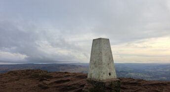
They range from the 287m summit of Thorpe Cloud at the gateway to Dovedale in the limestone “White Peak” to the remote moorland summits of Kinder Scout, Bleaklow and Black Hill in the northern gritstone “Dark Peak” area.
The highest is the top of Kinder Scout, at 636m above sea level.
CPRE PDSY supporter Doug Colton came up with the ‘Ethels’ idea. Doug then worked with us to create the app named “Ethel Ready”. It can now be downloaded for both Apple and Android.
It includes a tick-list accumulator that allows you to work your way through the hills entirely at your own speed.
“Some people may want to join them all up in a very long run. Others might want to take it more steadily, ticking off just one or two a year,” said Tomo Thompson.
“The app also has a CPRE tab that links to our website where you can learn more about our work, join our charity as a member, or make a donation to us.
“We have launched the app for free as we don’t actually ‘own’ those hills. We’ve just made a list of them!
“If you use the app we would be very grateful if you would consider making a donation to us to support our work.”